Blog

  • The Stitch Over the Ditch: Is it Worth the Money? And Does it Even Matter?

    In the mid 1940s, Atlanta was struggling. The city had grown far faster than its infrastructure could handle; a booming population, the rise of affordable personal automobiles, and industrial might were all befalling the city faster than Atlanta’s roads could keep up. And though the city had an expansive streetcar network at the time, that alone wasn’t going to keep the city afloat.

    Plans for the highway system through an Atlanta that was, at the time, dominated purely by railroads in every direction. Note the Belt Line encircling the city.

    Much like lobotomies, there was a solution to this problem that cities all over the United States (and the world, to be fair) were applying: carving up their downtowns and adding highways, many of which would be interstates by the time they were completed, right through the city center. This is a horrendous method of city design in so many ways, not the least of which is slashing the city in half to make way for drivers, the majority of which pass through, not into, the city. Even though this would have a profoundly negative effect on the city of Atlanta for the rest of its history, the popular personal automobile and highway technologies were relatively new, and so it is maybe understandable that city planners would think this was the best way to develop their cities in the new post-war world.

    Pictures of various predominantly black neighborhoods that would be razed to create the connector.

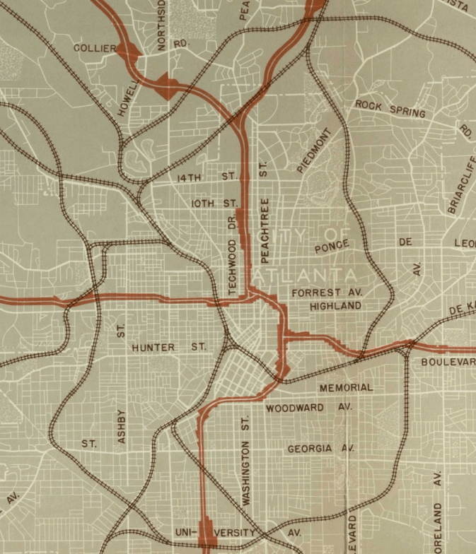
    What is most certainly not understandable is the massive number of people that were displaced by this project. Massive swaths of land in the middle of a city don’t just appear from thin air, and the designers of the highways knew exactly where to aim: black neighborhoods. And in a pre-Civil Rights era, there was nothing any of them could do about it. Of particular note for the sake of today’s topic is Buttermilk Bottom, the neighborhood sitting between what is now Downtown and Midtown, that was completely erased from the map in order to build the freeway. Buttermilk Bottom, like most of Atlanta’s black neighborhoods, was in dire need of infrastructure improvements, but the city forwent improving these districts in favor of demolishing them entirely.

    Buttermilk Bottom, shortly before its demolition.

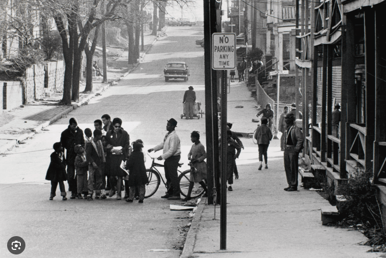
    Let me put in a disclaimer before we move on: I am absolutely not suggesting that The Stitch will somehow make up for the razing of Buttermilk Bottom or other neighborhoods. Those neighborhoods are gone, the people displaced for decades, and the new project doesn’t exactly give back to Atlanta’s black population in any special way; it is merely a development like any other. I believe the city of Atlanta as a whole, including its black population, will benefit from The Stitch, but it aggravates me when it is marketed as somehow giving back to those Buttermilk Bottom roots. But this history is incredibly necessary, and needs to be told – it will forever be the legacy of this area, and we cannot let it be forgotten.

    The section of the Connector that splits Downtown from Midtown.

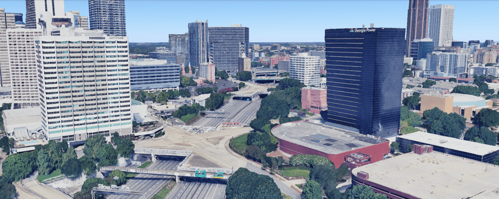
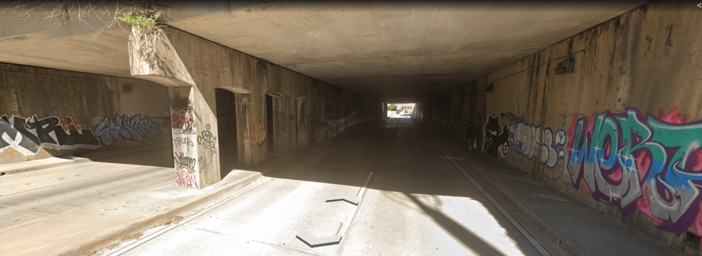
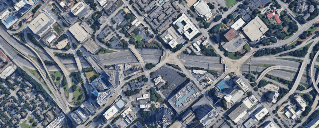
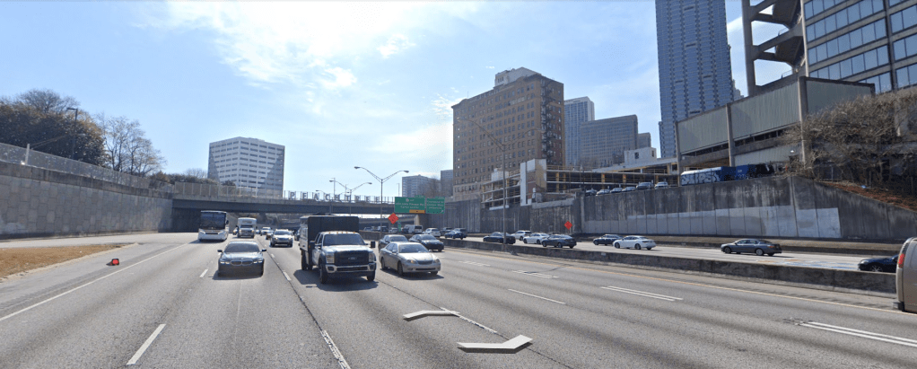
    Fast forward to today, the Connector has done a lot of damage to traffic flow in the city – there’s a reason Atlanta is notorious for its terrible traffic. And while the entire Connector has made Atlanta infamous for terrible traffic, one particular stretch stands out as particularly destructive: where the Connector crosses from the West side of Midtown to the East side of Downtown. This section of car sewer literally cuts the city in half, and the effects are much more than visual. Midtown has been thriving for the past couple of decades; the transformation from empty lots and 1 or 2 story buildings to a high-rise filled mixed-use urban haven has been staggering. But on the other side of the Connector, the love hasn’t been spread.

    Atlanta’s infamous Gulch. If this piece of land was in Midtown, it would have been snatched up and developed on years ago.

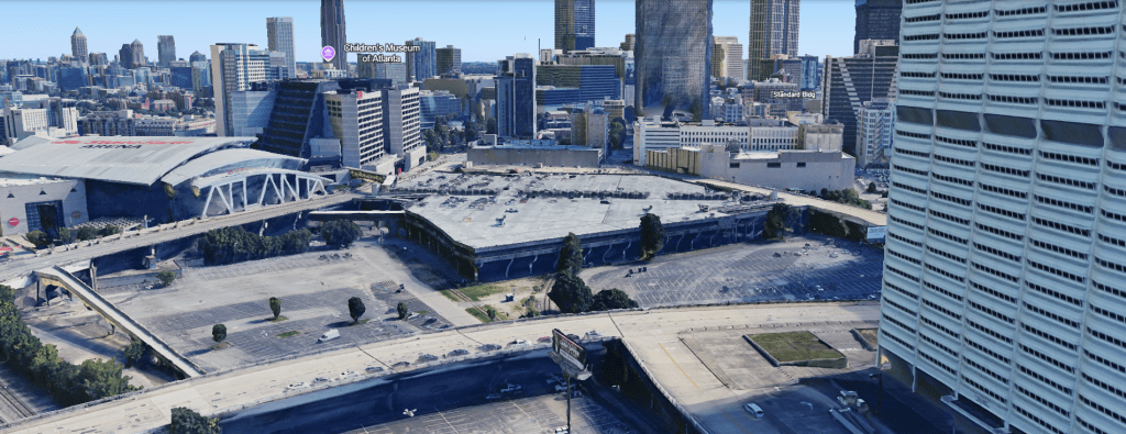
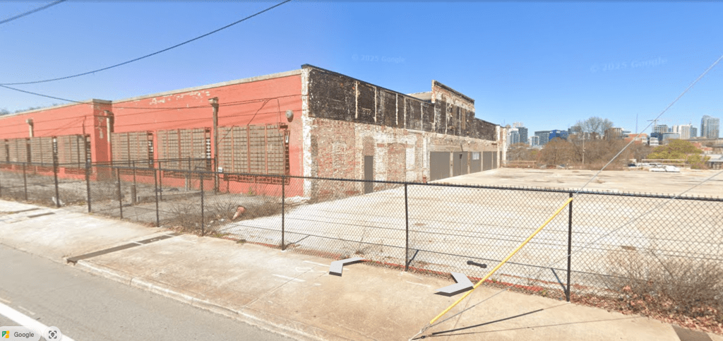
    Downtown Atlanta’s story has been a bit different to Midtown’s in the past few decades. There certainly hasn’t been no development – the City of Atlanta and Georgia State University have been revitalizing where they can – but the difference is clear. Private development has, until recently, been much slower, the area is still riddled with parking lots, and (especially in South Downtown) abandoned, shuttered buildings aren’t an uncommon sight. There are obviously a variety of reasons for this, and it’s beginning to change with public and private projects such as Centennial Yards and Georgia State’s Blue Line, but it is undeniable that the damn interstate creates a literal barrier between the success of the North and the stagnation of the South.

    The current Master Plan for The Stitch.

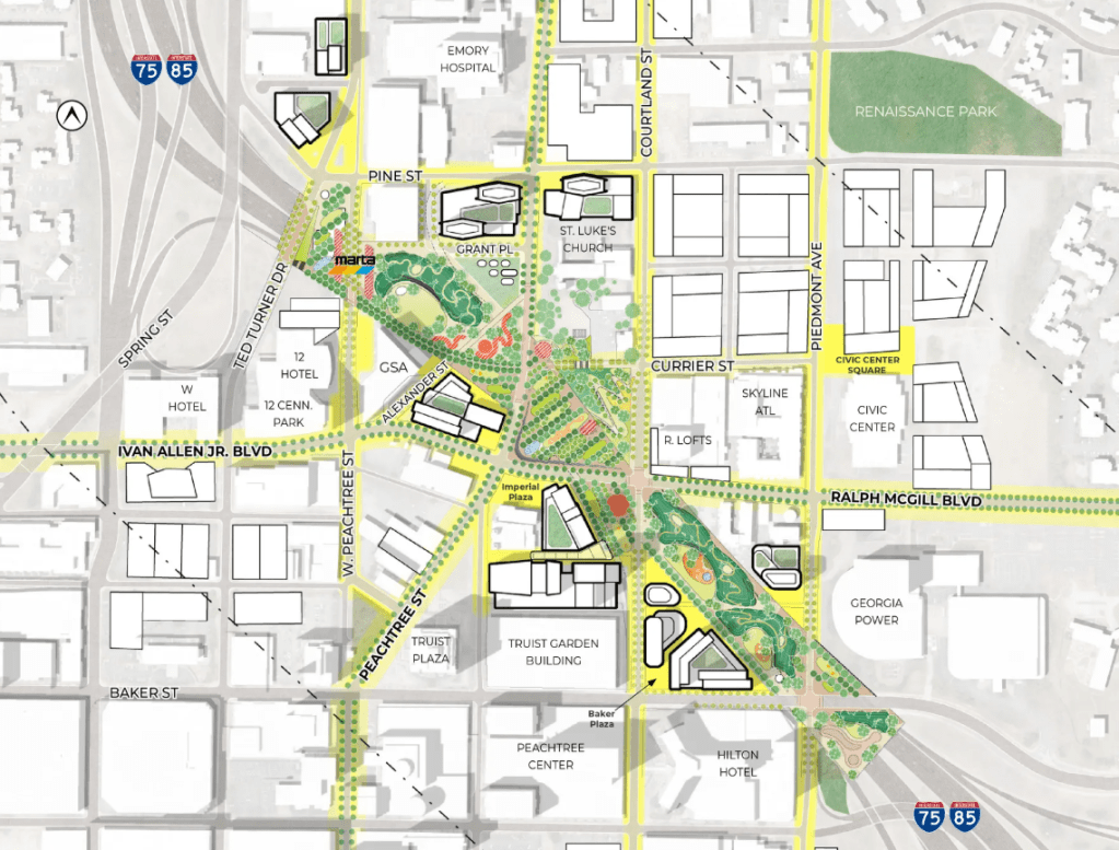
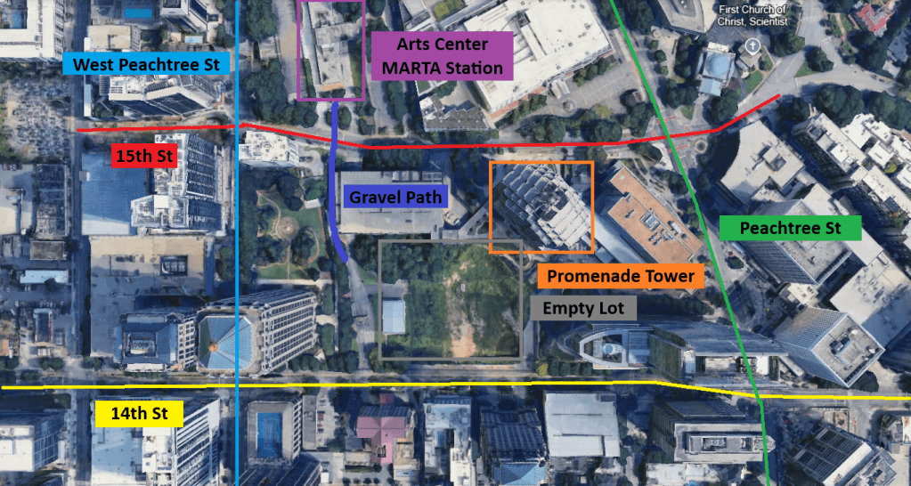
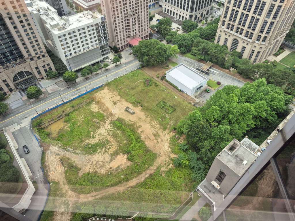
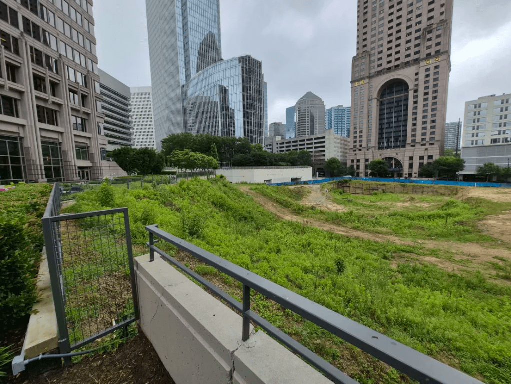
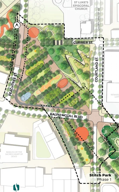
    Enter: The Stitch – And the name couldn’t be more fitting. The Stitch is a highway cap project that aims to erase the separation between Downtown and Midtown by creating several acres of land on top of the Connector. This land will then be developed with parks, offices, and most importantly, residential – a key component that Downtown is sorely lacking. Equally important are plans for affordable housing, better infrastructure for pedestrians and bikes, and integrating (and redeveloping) Civic Center MARTA Station into a vibrant community.

    Civic Center MARTA Station. Its brutalist design has not aged well in my opinion.

    The Stitch has its detractors though – most agree that the project would benefit the surrounding area from a development perspective, but there are questions of equity and gentrification. Midtown’s development has been rapid, but it has also been very expensive, and is mainly focused around higher end apartments and condos, as well as offices. While The Stitch has affordable housing goals, there are several projects around Atlanta that have set such goals in the past and failed to meet them. And then there is the simple element of money; is this really the best use of over $200m of federal funds? Where else could this money go? Perhaps it would be better spent on infrastructure in West and South Atlanta, where demographics are poorer, infrastructure is worse, and needs such as transit, food access, and safety are more pressing.

    The area in question. Note how there is an abundance of parking and wasted space around the Connector.

    And, oh no – did you hear that? Over $200m in federal funds. That doesn’t bode well for a project that’s only just getting rolling in year one of president Trump’s DOGE-driven administration. Atlanta is notorious for spending many years and massive amounts of money on studies just to never move forward with projects (see the recently cancelled Eastside Streetcar expansion). Federal funding is supposedly already secure, but is that really the case? It’s hard to tell what the future of this project is at the moment.

    A close-up of the first Phase of The Stitch.

    Personally, I hope the project comes to fruition. Despite gentrification concerns, I think development in Downtown Atlanta is inevitable. And while I understand that money could and probably should go to other parts of the city that need it more, the simple truth is that big flashy projects like The Stitch are more likely to earn federal grants than smaller projects, and we need to take advantage of opportunities as they come. The idea is, as The Stitch and other developments around Atlanta gain traction, they will spread development to other parts of the city that need it more. We are already seeing this happen Downtown, and hopes are high at the moment that South Downtown will see a similar revitalization in the coming years. The benefits to the economy, as well as quality of life for those who live in the area, will also have a positive impact on the city’s ability to improve areas in need.

    A view from the Connector looking Southeast. Note the abandoned brown Medical Arts Building – 384 Peachtree St – one of the buildings killed by the Connector.

    The damage of the connector is already done, and it can’t be fixed. Traffic infestation will forever be a part of Atlanta’s legacy, and the thousands of people it displaced will never get their land back. But as Atlanta’s resident’s we have a responsibility to ensure that projects like The Stitch doesn’t just become another skyline project for fat cat developers. We need to fight for issues in areas of the city that need it as well. And there’s no guarantee that either of those things will happen. But if we can use The Stitch as a catalyst for development, improvement, and good urban design, I think Atlanta as a whole will benefit, and maybe heal some of the scars that as of now remain completely exposed. And if we can get this project rolling, get it filled with affordable housing and parks and transit developments, maybe we can finally rectify some of the urban planning mistakes of our beautiful city’s past.

  • Sidewalks, Public Parks, and Getting People Where They Need to Go

    I take the train every day from my apartment in Edgewood-Candler Park to my job in Promenade Tower in Midtown Atlanta. Luckily for me, I live right next to Edgewood-Candler Park MARTA station, and the Promenade Campus is also right next to Arts Center Station. When everything is working correctly, my commute never takes more than 30 minutes. I consider myself very lucky that I get to have this commute while living the car-free lifestyle that I choose.

    Promenade Tower exists in a rather large block in Midtown; a block bordered by 15th and 14th streets, as well as the confusingly named Peachtree and West Peachtree Streets. Unlike many of the other blocks in Midtown, there is no North-South street in between Peachtree and West Peachtree. And this creates a unique situation that I have been thinking about for a while.

    The crossing across 15th St that I take every day to get to work. Left is looking towards Arts Center Station, right is looking away from Arts Center Station, towards my block.

    See that gravel path in the image above, represented with dark blue on the map? That path is walked by hundreds of people every day who exit Arts Center Station looking to reach the buildings on 14th St and beyond. I see people climbing this little dirt path every day. They walk in the dirt right next to a massive parking garage, only to come out on the other side onto a road without a sidewalk where they can easily be hit by cars entering the garage. Only after walking on the hilly grass besides the toll booth guarding the parking garage can they reach 14th St. The second half of that commute is shown below:

    Looking North from 14th St where pedestrians coming from Arts Center Station must walk. Note the pedestrian on the right taking this path, walking in the middle of the road as there is no other path for them.

    This is a very interesting phenomenon to me. These pedestrians could simply walk a few meters west, then head south down West Peachtree, and then head back east up 14th St to reach their destination, but instead they choose to take this shorter route even though it is actively pedestrian-unfriendly. It seems like the designers of this block didn’t truly understand the walking patterns of the local pedestrians. They either A. believed that building a big parking garage would force the pedestrians to take the longer route, or (more likely) B. didn’t put much thought into it at all. And that’s a shame, because that longer route isn’t just more pedestrian friendly, but it’s much nicer.

    The small public plaza that also resides in this block that pedestrians could walk through if they took the slightly longer route.

    But this could all be about to change (Key word: could). You see there is another resident in this massive city block. Or should I say, a lack of a resident. And my office gets a first-class view of this ugly empty lot right in the middle of some of the most valuable land in the state of Georgia.

    The empty lot along 14th St. Photo taken from the window of my office’s conference room.

    This lot, right in the middle of the city, directly next to a MARTA station, and surrounded by skyscrapers on all sides was supposed to have a residential tower, named Opus, starting construction around 2020. You can even see the temporary leasing office for Opus still there – it’s the small white building by the toll booths. Then some big thing happened in 2020, I can’t quite remember what that was, and all the plans for the lot went out the window. It sat there in its half-dug-up state for 4 years before the city finally bought it and announced what they were going to do with it: turn it into a park.

    The empty lot looking from the Promenade Campus. Note the wall of fencing and foliage that blocks Promenade from 14th St.

    The announcement of the property being a park was met with mixed reactions. On one hand, parks are great, and Midtown doesn’t have a lot of them. On the other hand, the land is very valuable, and could easily see more development for the city. Look at the picture above. Pedestrians from Arts Center Station aren’t the only ones who use that horrible parking garage road to get to 14th St. Any time someone in our office needs to get to 14th or beyond, we have to walk through the parking garage and then exit where the pedestrians from earlier came out.

    My hope is that the park accomplishes 2 things. First and foremost, I simply hope it’s good, effective, nice park space for the city. They haven’t decided what type of amenities are going to be in the park just yet, or even what kind of park it’s going to be. And there are probably more opportunities here than you realize.

    But my second hope is that they take advantage of this construction to add some pathways, both from Arts Center MARTA Station and from the Promenade Campus, to finally make this large block walkable for pedestrians. It’s only a matter of time before someone gets hit by a car on the way out of the parking garage, or twists their ankle on the steep gravel hill or grassy area besides the toll booths. Either of these things may have happened already.

    I will update this blog as the construction begins, and see what they do with the space. But I found this scenario interesting, not just because it applies to me directly, but because it’s a little insight into how people don’t always behave how city planners want them to. As urban designers, we need to understand where people need to walk and facilitate their travels, even when alternate options are seemingly better for the city and pedestrians.

  • Georgia Tech Announces New “Creative Quarter”

    Georgia Tech recently unveiled plans for a new “Creative Quarter” on the Southwest side of Tech’s main campus. The previously announced “Science Square” has been underway for a while now, but there’s a big problem: it lies on the other end of the tracks from the Tech campus, and the only way to get to it as a pedestrian is via a sidewalk of North Ave, a horrible 4-lane stroad, under a dingy tunnel.

    The horrible conditions one must walk through to get across the tracks.

    That’s all set to change however, as Tech is also building a large Pedestrian Bridge that will connect both sides of the tracks in a perfect way for pedestrians. These railroad tracks are more than an inconvenience; they have been a barrier that has separated West Atlanta from the city center for as long as the city has been around. To the North of the planned bridge, there isn’t a single pedestrian crossing of the tracks that isn’t attached to a stroad at least 4 lanes wide. To the South, you have to go all the way to the Georgia World Congress Center to find anything better for pedestrians.

    My biggest question, however, is what lies beyond Science Square? Sitting to the southwest of the Tech development is a little under 60 acres of completely unutilized land. Well, half of it is unutilized; the other half is parking for….. something. When the Falcons play the lots fill up, but most of the rest of the time they lie completely empty; dozens of acres of wasted space. But with Tech expanding into the area, and connecting the area to the main campus via the pedestrian bridge, could this be a new chapter for this area?

    And I’m not just talking about Tech itself developing the land; this is a perfect place for student housing. But students need food, jobs, and entertainment right? It could be that, 10 years from now, the area is bustling with development, similar to how the Summerhill district is booming now that Georgia State has moved into the area.

    But this post is titled after the Creative Square, so what’s the deal with that? Well, Tech have recently bought a plot of land that used to be a construction company, and, well…. let’s just call it unsightly…

    It’s the ideal piece of land to expand into. A dirty, ugly, fenced-off abandoned lot. No need to displace people, no trees to tear down, just reimagining a concrete lot. It’s perfect for redevelopment. Hats off to Tech for choosing this location, and hats off to the previous owners, Randall Brothers Construction Materials, for selling it.

    And there are even more opportunities abound. Just to the west of this area is the Atlanta BeltLine connector, which will undoubtedly prove to be a key connector between Atlanta’s revolutionary BeltLine and the city center. If Tech and/or the City of Atlanta are smart, they will use this new development as a way to steer pedestrian traffic and locals to the BeltLine. In my opinion, this section of North Ave, and especially the intersection of North and Northside, should be redone to allow a direct pedestrian connection between the BeltLine and this new Tech bridge. Only time will tell if that actually happens, though.

  • What This is All About

    This is my blog where I am going to be studying urban design and public transit. I’ll put my opinions, research, and updates here. Feel free to follow along, and suggestions are always welcome!